
Welcome back to the Extra Edition newsletter! I’m excited to bring you bonus content each month with a special inside look at my novels and the history behind them.
On Location
We’ve been talking a lot lately about my next book, so for today, let’s go back to Larksong as we travel the Oregon Trail in For a Noble Purpose.
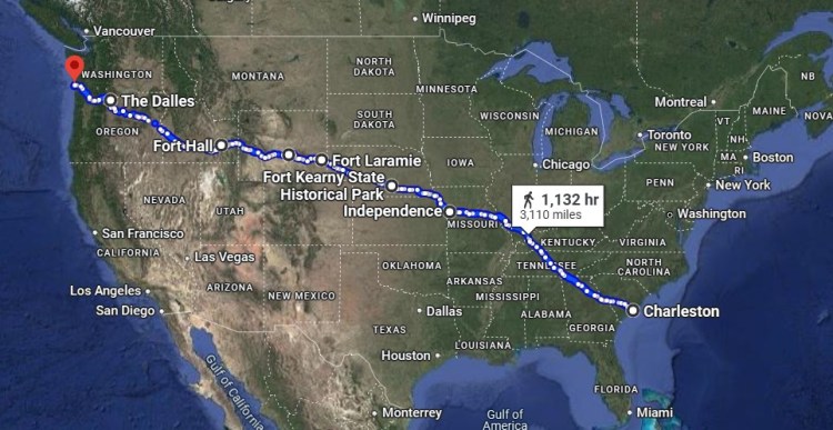
In 1852, pioneers rarely rode in their wagons as the space was needed for supplies. This meant that they walked between 15-25 miles per day on open prairie, fewer if they were traveling through a town such as between Charleston, South Carolina and St. Louis, Missouri. This 3,110 mile journey took the Larks about a year to travel. While they would have seen many areas throughout their journey, here are the main historical landmarks included in the book:
Starting Point – Larksong Plantation, Charleston, SC
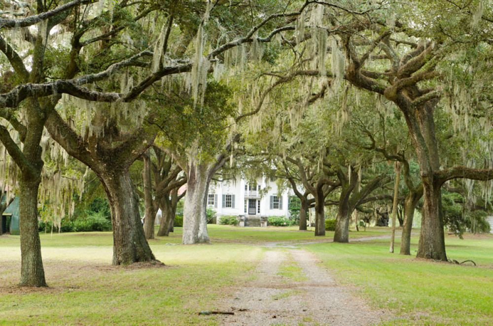
Larksong Rice Plantation was inspired by many South Carolina plantations, the most notable being McLeod (cotton) and Hampton (rice). Although these plantations farmed different products, their basic layout was similar. The Spanish-moss-draped-live oaks of McLeod’s front drive (above) is the closest to what I pictured for Larksong Plantation.
Stop #1 – Walcott Plantation, Hawthorn Ridge, MO

If Hawthorn Ridge, Missouri was a real city, it would be located in Little Dixie, an area which encompassed several counties across Mid-Missouri. Walcott Hemp Plantation was inspired by Missouri’s real plantations, all of which were smaller than either McLeod or Hampton plantations, and most of which have been torn down. One exception is Prairie Park, originally known as William B. Sappington Plantation, which is currently a private residence. Prairie Park’s house (above) is similar to what I pictured for the Walcotts, except with a white exterior.
Stop #2 – Oregon Trail Trailhead, Independence, MO
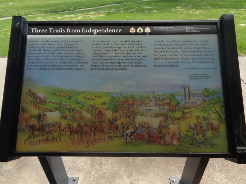
In 1852, Independence, Missouri was the jumping off point for three westward trails: the Oregon, the Santa Fe, and the California. The Oregon Trail alone saw one of its busiest summers that year with 70,000 people traveling, sometimes 12 wagons across. As Sarah describes it in For a Noble Purpose, Independence was both a “small town grand in diversity” and also “near pandemonium.”
Stop #3 – Fort Kearney, Nebraska
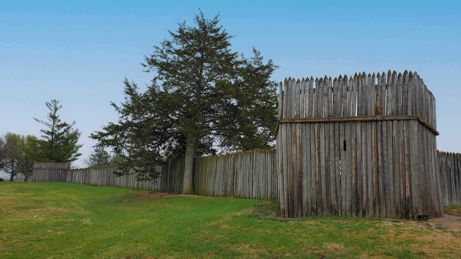
Just one of several forts along the trail, Fort Kearney was established in 1848 to protect travelers, provide a spot for purchasing supplies and posting letters, serve as a station for Pony Express riders and Native American scouts, and act as a post for military troops and railroad crews. It is now maintained as a Nebraska state park.
Stop #4 – Platte River, Nebraska
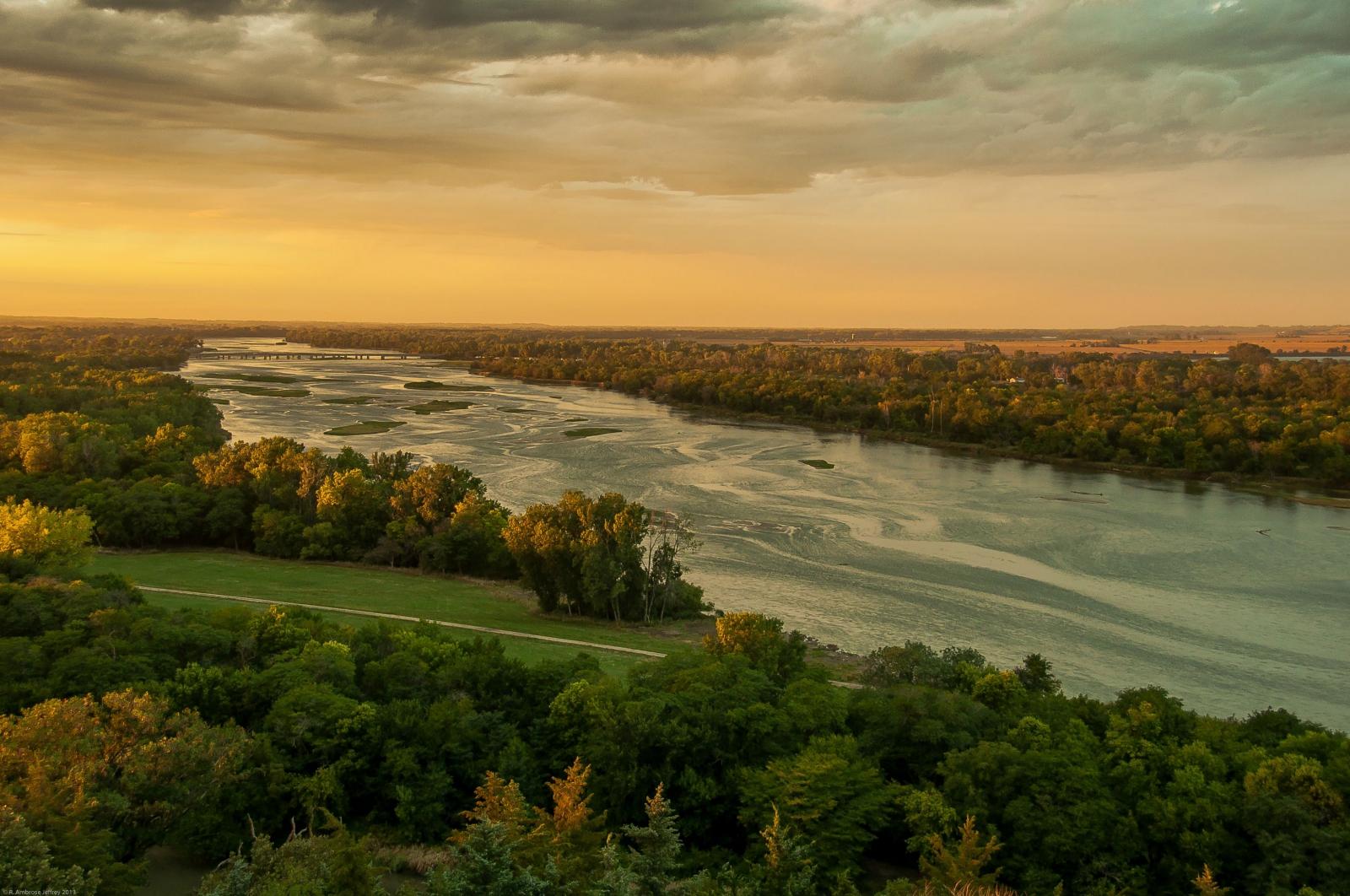
The Platte River followed much of the trail in Nebraska with high grass or trees on one side and flowing water on the other, running over 300 miles to Wyoming. It would have been important not to let children or animals wander off into the grass for fear of never finding them again. The river was also a prime location for washing clothes and dumping waste, leading to an increase in cholera cases along its banks.
Stop #5- Fort Laramie, Wyoming
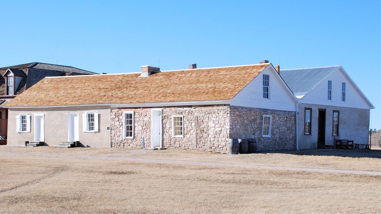
Originally established as a fur trading fort in 1830, Fort Laramie was another spot along the trail where travelers could rest and resupply. It was used as a military post until 1890 with a wide variety of buildings, almost like a small town. It welcomed a variety of people including trappers, traders, Native Americans, missionaries, emigrants, soldiers, miners, ranchers and homesteaders. It is now maintained by the National Park Service as a historic site. The photo above shows a reconstruction of the Post Traders Store, originally built in 1849. This is where the Larks would have purchased supplies.
Stop #6 – Independence Rock, Wyoming
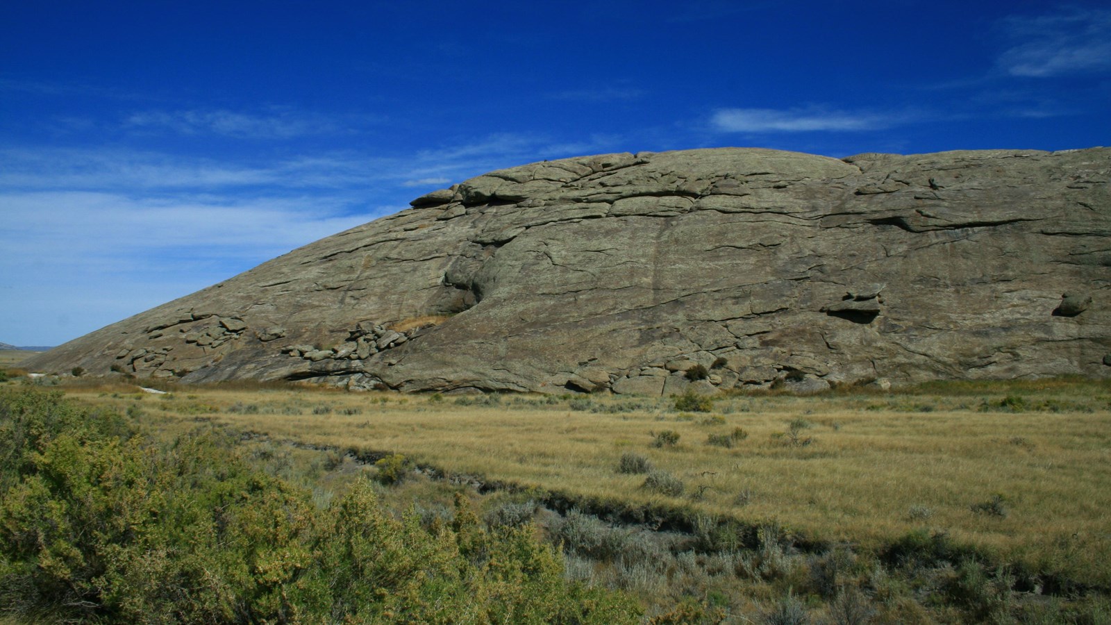
Due to its size at 1,900 feet long by 850 feet wide by 136 feet tall, Independence Rock was said to have been the most notable site along the westward trail. Thousands of travelers camped along its base and many of those climbed to its top to appreciate the view and carve their names into The Great Registry of the Desert. As Martha says in For a Noble Purpose, “Nothing in Missouri is like this.” Independence Rock is now maintained by the National Park Service, although visitors can still climb to the top.
Stop #7 – Fort Hall, Idaho

Built in 1834 and demolished in 1863, Fort Hall was a trading post along the Snake River, the final fort before reaching Oregon. Since the Larks were continuing on to Washington Territory, they would have had two more opportunities for supplies at Fort Astoria and Fort Vancouver, although neither are visited in the story. A second Fort Hall was constructed after destruction of the first and included within the Shoshone-Bannock Indian Reservation under the treaty of 1867. A replica of the first fort was built in the 1960s and can be visited to this day.
Final Destination – Larksong, Washington
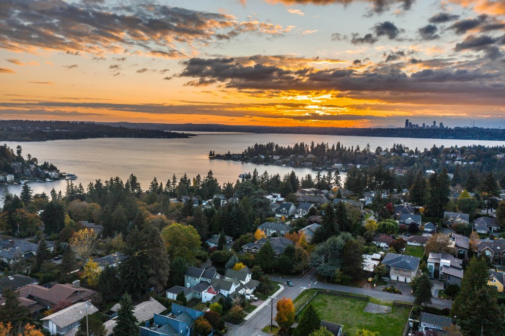
After Fort Hall, the Larks would have continued northwest through Oregon until they reached what is now Washington State. The area that I placed their town in was just north of the Columbia River, overlooking Shoalwater Bay (now Willapa Bay) and near the Chinook Native American tribe. It is still part of The Chinook Indian Nation to this day. Without paved roads or modern buildings, the area was a vast wilderness and an amazing site to behold. The photo above is from a town closer to Seattle, but I think it still shows the beauty of the area. As one of the characters describes it in For a Noble Purpose, “The pioneers continued northward until they arrived at the promised claim, the azure ocean at their faces and evergreen forests at their backs. Breathtaking. There would be much to accomplish in order to make the space habitable, trees to fell and buildings to raise before it could be considered a town. Still, what a vision to surround them while they built their dreams.”
To view an interactive map of all the Oregon Trail sites, visit: https://www.nps.gov/oreg/planyourvisit/places-to-go.htm
Until next time, happy reading!
Ad Majorem Dei Gloriam
Kelsey
Purchase signed copies of my books: kelseygietl.com

Follow me on:


COPYRIGHT © KELSEY GIETL 2025
Purple Mask Publishing
2025 Zumbehl Rd, Ste. 33
St. Charles, MO 63303

This is so fun! I love that you mapped it out.
LikeLiked by 1 person
Thank goodness for the internet! We can vicariously live through characters without the travel expenses. 🙂
LikeLiked by 1 person
Yes! I love that about books too. That we can travel through them.
LikeLike